Ashraf Engineer
January 21, 2023
EPISODE TRANSCRIPT
Hello and welcome to All Indians Matter. I am Ashraf Engineer.
You would have seen the horrifying pictures of a sinking Joshimath, the pilgrim stopover in Uttarakhand. Land subsidence caused houses and roads to crack, forcing the administration to order an emergency evacuation and shift families to safer locations. What led to the ‘sinking’ of Joshimath and what can be done now? As always, the answer lies in human actions.
SIGNATURE TUNE
Residents and experts were quick to blame the development projects undertaken in the Joshimath region. These include NTPC’s 520 MW Tapovan-Vishnugad Hydropower Project and the Char Dham project for which roads are being widened. For the NTPC project, a tunnel was bored under the town of Auli near Joshimath, which punctured an aquifer in 2009. This led to massive seepage and the draining of nearby water resources. Water is pouring out from cracks in several locations even today. A study done in 2010 by the Dehradun-based Disaster Mitigation and Management Centre, or DMMC, and Garhwal University said the puncturing of the aquifer 5 km from Joshimath led to water discharge of 700-800 litres per second. It was soon after this that groundwater sources in Joshimath started going dry. Incidentally, Joshimath Bachao Sangharsh Samiti activists have been protesting against the NTPC project since 2004.
Meanwhile, the 6-km Helang-Marwari bypass, part of the Char Dham Project, is said to have weakened hill slopes and destabilised the topography. Explosives were used in the construction, along with methods like drilling. This could have impacted the foundations of Joshimath. The Supreme Court had ordered a high-powered committee to review the project and suggested a geotechnical feasibility study but the recommendations seem to have been ignored.
Tourism brings along its own pressures. Joshimath is a night halt for pilgrims en route to Badrinath and Shri Hemkund Sahib and for tourists going to the Valley of Flowers and to the ski resort of Auli. As a result, hotels have mushroomed across the town but the underlying soil probably lacks the load-carrying capacity needed for the infrastructure.
The pilgrims and tourists consume a lot of of water, which means that large amounts of groundwater are extracted. Because of this, specific types of rocks, such as fine-grained sediments, collapse in on themselves. This too destabilises the topography.
The construction hasn’t been accompanied by proper drainage facilities. What’s been built instead are soak pits through which the water goes into the ground, creating cavities between the soil and the rocks and leading to erosion.
There are natural factors too. Joshimath sits in Seismic Zone V, which is prone to earthquakes, gradual weathering and water percolation. This erodes rocks’ cohesive strength over time. According to the Mishra Committee report of 1976, Joshimath lies atop a sand and stone deposit and most of the town was built on the debris of landslides. These slopes turn unstable at the slightest of triggers. The committee also said that the land subsidence of that time might have been triggered by the reactivation of a geographic fault where the Indian Plate pushes under the Eurasian Plate along the Himalayas. This effect would last till today.
Severe weather events haven’t helped matters. DMMC data shows that from 2015 to mid-2021 Uttarakhand had 7,750 cloudbursts and extreme rain incidents. Erosion increased after the February 2021 and June 2013 floods and the incessant rain in October 2021, exacerbating land subsidence.
But it’s mainly human construction and scant respect for the environment that have led to the disaster. In fact, the Uttarakhand State Disaster Management Authority published a report just last September that blamed ill-planned construction as the main cause of the land sinking. It also mentioned the inadequate drainage systems.
As Joshimath sank, the Chamoli administration temporarily halted construction on the Helang-Marwari bypass and the NTPC project but it it’s come after the proverbial horses have bolted.
Before I proceed, a word on land subsidence.
According to the National Oceanic and Atmospheric Administration, it means “sinking of the ground because of underground material movement”. It can happen for several reasons, manmade or natural, such as the extraction of water, oil or other natural resources, and also mining. It could also be caused by earthquakes or soil erosion and compaction.
What’s shocking is that warnings of such a situation occurring were issued long ago. Why were they ignored by the government?
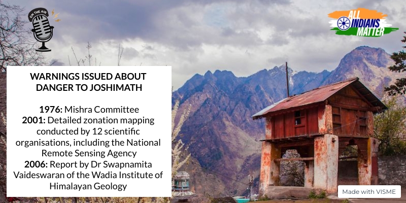
As I said, the Mishra Commission report of 1976 revealed that Joshimath was located in an ancient landslide zone and did not have a high load-bearing capacity.
Even in 2006, a report by Dr Swapnamita Vaideswaran of the Wadia Institute of Himalayan Geology said that the soil of Joshimath might have been loosened due to seepage from streams.
It’s been revealed now that a detailed zonation mapping of the Himalayas in Uttarakhand and Himachal Pradesh, warning of the danger to Joshimath, was submitted to the state government as far back as 2001. The study used remote sensing and Geographic Information Systems and was conducted by 12 leading scientific organisations, including the National Remote Sensing Agency.
The situation today, then, is clearly a failure of successive governments.
I want to return to the Mishra Committee report. What were its recommendations?
- The key preventive measure suggested was a restriction on heavy construction. If it is to be done, it should only be after the soil’s weight-bearing capacity and site stability is studied
- When fixing roads or building structures, boulders should not be removed by digging or blasting
- Fill the cracks appearing on the slopes
- Conduct extensive plantation, especially between Marwari and Joshimath, to conserve soil and water resources, and there should be no cutting of trees in the landslide zone
- The slopes should not be used for agriculture
- Have a pucca drainage system and don’t allow water to accumulate in depressions
- Position cement blocks in areas of the riverbank that are susceptible to erosion
These were the Mishra Committee’s recommendations. But what should the Uttarakhand government do now? Here are some measures experts have recommended:
- Balance development with environmental protection
- Natural assets of the Himalayas, such as biodiversity, should be at the centre of any development plan
- Instead of massive dam construction, focus on smaller projects that can meet the energy needs of the local community
- Implement the Mishra Committee recommendations for all development projects
The Joshimath crisis is emblematic of the harm indiscriminate development in geologically unstable regions can do. Surely, we need a relook of the development model we are following. Unless we put sustainability at the top of the agenda, Joshimath won’t be the only town to go under.
Thank you all for listening. Please visit allindiansmatter.in for more columns and audio podcasts. You can follow me on Twitter at @AshrafEngineer and @AllIndiansCount. Search for the All Indians Matter page on Facebook. On Instagram, the handle is @AllIndiansMatter. Email me at editor@allindiansmatter.in. Catch you again soon.